Official Name:
下扎扎长城2段XiaZhaZhaChangCheng2DuanOur Name:
边墙 / BianQiang
Other Name:
/
Period:明 / Ming Dynasty 1368~1644
Location: 青海省,西宁市,湟中县,起点:汉东回族乡下扎扎村东0.68千米处的自然冲沟沟口止点:汉东回族乡下扎扎村东0.67千米处的自然冲沟沟口 / QingHaiSheng,XiNingShi,ZhongXian,QiDianHanDongHuiZuXiangXiaZhaZhaCunDong068QianMiChuDeZiRanChongGouGouKouZhiDianHanDongHuiZuXiangXiaZhaZhaCunDong067QianMiChuDeZiRanChongGouGouKou
[
Looking Local List]
Details:长城类别:墙体
起点经纬高度:东经:101° 30′ 北纬:36° 36′ 海拔:2515
终点经纬高度:东经:101° 30′ 北纬:36° 36′ 海拔:2519
墙体走向:该段墙体呈东南-西北向横截自然冲沟沟口。
墙体类别情况及构筑方式:夯筑土墙。系用黄土夯筑而成,夯层厚0.14米~0.15米。
墙体类别:土墙
结构特点及构筑方式:该段墙体系在自然基础上直接夯筑而成。墙体底宽0.8米,顶宽0.3米,残高1.3米。
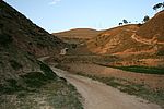
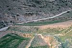
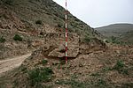
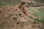
墙体分段描述:该段墙体起自GPS0383点,止于GPS0384点,全长36米。墙体保存差。墙体内侧(东北)为耕地,几与墙体顶部齐平,现种有大豆,外侧(西南)为便道。0米~29.4米段墙体仅剩底部,被堆土所掩埋。29.4米~33米段长3.6米部分墙体底宽0.8米、顶宽0.3米、残高1.3米,夯层厚0.14米~0.15米;墙体表面有版接缝一条,片状脱离现象严重,底部因酥碱而凹进。33米~36米段长3米墙体被山路所毁。墙体顶部及外侧堆土上冰草杂生。无。
现状:
Type:土墙 Rammed earth wall
Protection Level:无
Content:
Memo:
Other Records:
Distribution:
visit location in Tianditu Map[recommend] Distribution:
visit location in Tencent QQ Map Distribution:
visit location in Google MapDistribution:
visit location in Baidu MapNational ID:630122382101170021
Action:[
 Save in Data Basket
 ]
Picture:
Click the thumbnail to view the Big Pic. Click the Big Pic to Hide the Big Pic![Caption:下扎扎长城2段
loading images --Please wait...]()
![Caption:下扎扎长城2段
loading images --Please wait...]()
![Caption:下扎扎长城2段
loading images --Please wait...]()
![Caption:下扎扎长城2段
loading images --Please wait...]() Photo Links
Photo Links:
 Search ::
  My Data Basket ::
  Favorite/My Favorite :: Recent Changes :: :: Login
 Save in Data Basket ]


