Official Name:
麻黄梁村马面MaHuangLiangCunMaMianOur Name:
/
Other Name:
/
Period:明 / Ming Dynasty 1368~1644
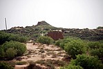
Location: 陕西省,榆林市,榆阳区,麻黄梁镇大圪垯村麻黄梁村西南1228米 / ShanXiSheng,YuLinShi,YuYangQu,MaHuangLiangZhenDaCunMaHuangLiangCunXiNan1228Mi
[
Looking Local List]
Details:长城类别:单体建筑
经纬高度:东经:109° 57′ 北纬:38° 27′ 海拔:1286.80
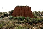
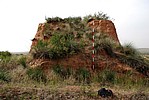
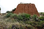
建筑形式:该马面建在麻黄梁村西南1228米的沙漠中的夯土包砖马面,台体南侧紧贴0026段长城,台体以黄土和料礓石夹杂,层层夯筑而成,外层包石包砖;台体顶部原来应该有建筑物,现在台体顶部有约0.4米的堆积层,内夹杂石灰渣、砖块、瓦片等,台体南侧有登台踏步,现在呈斜坡状,宽3.4米,高1.2米,进深1.8米;现存台体平面呈方形,剖面呈梯形。
建筑材料:台体以黄土和料礓石夹杂,层层夯筑而成,夯层厚0.08米~0.14米,台体原来均有包石包砖,被周围居民人为拆除,现在台体东侧、西侧、北侧底部均有人为挖掘台体包石的深槽,并有大量的堆积土,现在周围散落残砖和白灰渣,白灰渣层厚0.011米。
建筑尺寸:台体底部边长8米,顶部东西6米,南北5.1米,残高5.8米。
材料:
附近遗存:
Type:马面 Horse face like battle platform
Protection Level:无
Content:
Memo:
Other Records:
Distribution:
visit location in Tianditu Map[recommend] Distribution:
visit location in Tencent QQ Map Distribution:
visit location in Google MapDistribution:
visit location in Baidu MapNational ID:610802352102170091
Action:[
 Save in Data Basket
 ]
Picture:
Click the thumbnail to view the Big Pic. Click the Big Pic to Hide the Big Pic![Caption:麻黄梁村马面
loading images --Please wait...]()
![Caption:麻黄梁村马面
loading images --Please wait...]()
![Caption:麻黄梁村马面
loading images --Please wait...]()
![Caption:麻黄梁村马面
loading images --Please wait...]()
![Caption:麻黄梁村马面
loading images --Please wait...]() Photo Links
Photo Links:
 Search ::
  My Data Basket ::
  Favorite/My Favorite :: Recent Changes :: :: Login
 Save in Data Basket ]


