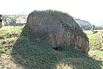
Official Name:
口子上1段3号敌台KouZiShang1Duan3HaoDiTaiOur Name:
墩台 / DunTai
Other Name:
/
Period:明 / Ming Dynasty 1368~1644
Location: 内蒙古自治区,呼和浩特市,清水河县,目爱泉乡口子上村东约0.75千米 / NeiMengGuZiZhiQu,HuHeHaoTeShi,QingShuiHeXian,MuAiQuanXiangKouZiShangCunDongYue075QianMi
[
Looking Local List]
Details:长城类别:单体建筑
经纬高度:东经:111° 52′ 北纬:39° 39′ 海拔:1547
建筑形式:敌台为夯筑,平面呈长方形,剖面呈梯形。
材料:黄土。
附近遗存:其东方约0.15千米处为口子上2号敌台。
Type:敌台 Defence Tower
Protection Level:国保
Content:
Memo:
Other Records:
Distribution:
visit location in Tianditu Map[recommend] Distribution:
visit location in Tencent QQ Map Distribution:
visit location in Google MapDistribution:
visit location in Baidu MapNational ID:150124352101170133
The original number submitted by the local government :150124352101170131
(when the Great Wall is identified, the data whose code has been adjusted will display the original number submitted by the local government before revision, which can be used by the local cultural relics department when checking the local data.)
Action:[
 Save in Data Basket
 ]
Picture:
Click the thumbnail to view the Big Pic. Click the Big Pic to Hide the Big Pic![Caption:口子上1段3号敌台
loading images --Please wait...]() Photo Links
Photo Links:
 Search ::
  My Data Basket ::
  Favorite/My Favorite :: Recent Changes :: :: Login
 Save in Data Basket ]