Official Name:
炮手营子烽火台PaoShouYingZiFengHuoTaiOur Name:
/
Other Name:
/
Period:汉 / Han Dynasty 206 B.C.~316A.D.
Location: 内蒙古自治区,赤峰市,喀喇沁旗,乃林镇炮手营子村南0.39千米 / NeiMengGuZiZhiQu,ChiFengShi,KaLaQinQi,NaiLinZhenPaoShouYingZiCunNan039QianMi
[
Looking Local List]
Details:长城类别:单体建筑
经纬高度:东经:119° 05′ 北纬:41° 52′ 海拔:570
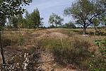
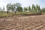
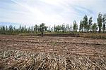
建筑形式:由于破坏严重,致使烽火台消失,其形制结构不详。
材料:根据此处地貌特征判断为黄土夯筑.
附近遗存:东距百宝营子烽火台645米。
Type:烽火台 Beacon Tower
Protection Level:无
Content:
Memo:
Other Records:
Distribution:
visit location in Tianditu Map[recommend] Distribution:
visit location in Tencent QQ Map Distribution:
visit location in Google MapDistribution:
visit location in Baidu MapNational ID:150428353201040011
Action:[
 Save in Data Basket
 ]
Picture:
Click the thumbnail to view the Big Pic. Click the Big Pic to Hide the Big Pic![Caption:炮手营子烽火台
loading images --Please wait...]()
![Caption:炮手营子烽火台
loading images --Please wait...]()
![Caption:炮手营子烽火台
loading images --Please wait...]() Photo Links
Photo Links:
 Search ::
  My Data Basket ::
  Favorite/My Favorite :: Recent Changes :: :: Login
 Save in Data Basket ]

