Official Name:
青山长城2段QingShanChangCheng2DuanOur Name:
/
Other Name:
/
Period:汉 / Han Dynasty 206 B.C.~316A.D.
Location: 朝阳市,建平县,起点:张家营子镇青山村南1600米止点:张家营子镇青山村南1500米 / ChaoYangShi,JianPingXian,QiDianZhangJiaYingZiZhenQingShanCunNan1600MiZhiDianZhangJiaYingZiZhenQingShanCunNan1500Mi
[
Looking Local List]
Details:长城类别:墙体
起点经纬高度:东经:119° 46′ 北纬:41° 43′ 海拔:827
终点经纬高度:东经:119° 46′ 北纬:41° 43′ 海拔:811
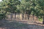
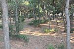
墙体走向:该段墙体起于青山2号烽火台,沿东南-西北向在山坡蜿蜒穿行于松林间,止于山坡上。
墙体类别:石墙
结构特点及构筑方式:不清。墙体以自然山体为基础,两侧用较大石块逐层错缝垒砌,中间填土和碎石。现存墙体剖面呈漫圆形,宽6米,保存最高处0.40米。
现状:石墙。
Type:石墙 Stone wall
Protection Level:省保
Content:
Memo:
Other Records:
Distribution:
visit location in Tianditu Map[recommend] Distribution:
visit location in Tencent QQ Map Distribution:
visit location in Google MapDistribution:
visit location in Baidu MapNational ID:211322382102040002
Action:[
 Save in Data Basket
 ]
Picture:
Click the thumbnail to view the Big Pic. Click the Big Pic to Hide the Big Pic![Caption:青山长城2段
loading images --Please wait...]()
![Caption:青山长城2段
loading images --Please wait...]() Photo Links
Photo Links:
 Search ::
  My Data Basket ::
  Favorite/My Favorite :: Recent Changes :: :: Login
 Save in Data Basket ]
