Official Name:
幸福村长城1段XingFuCunChangCheng1DuanOur Name:
/
Other Name:
/
Period:北魏 / Northern Wei 386~534
Location: 内蒙古自治区,包头市,达尔罕茂明安联合旗,起点:石宝镇幸福村东北2.7千米止点:石宝镇幸福村西南0.7千米 / NeiMengGuZiZhiQu,BaoTouShi,DaErHanMaoMingAnLianHeQi,QiDianShiBaoZhenXingFuCunDongBei27QianMiZhiDianShiBaoZhenXingFuCunXiNan07QianMi
[
Looking Local List]
Details:长城类别:墙体
起点经纬高度:东经:110° 59′ 北纬:41° 26′ 海拔:1685
终点经纬高度:东经:110° 58′ 北纬:41° 24′ 海拔:1682
墙体走向:
墙体类别:土墙
结构特点及构筑方式:不详。基础不详,底宽约2-7米,高0-0.3米。
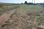
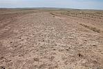
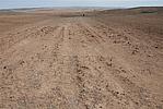
现状:土墙。此段墙体长3101米,全为保存差。起点处为柠条地,向西呈“S”形分布。墙体后半部分在道路底下,南侧有废弃的耕地,北侧有条土路,止点在耕地中,隐约可见隆起的墙体,但濒临消失。
Type:土墙 Rammed earth wall
Protection Level:无
Content:
Memo:
Other Records:
Distribution:
visit location in Tianditu Map[recommend] Distribution:
visit location in Tencent QQ Map Distribution:
visit location in Google MapDistribution:
visit location in Baidu MapNational ID:150223382101060060
Action:[
 Save in Data Basket
 ]
Picture:
Click the thumbnail to view the Big Pic. Click the Big Pic to Hide the Big Pic![Caption:幸福村长城1段
loading images --Please wait...]()
![Caption:幸福村长城1段
loading images --Please wait...]()
![Caption:幸福村长城1段
loading images --Please wait...]() Photo Links
Photo Links:
 Search ::
  My Data Basket ::
  Favorite/My Favorite :: Recent Changes :: :: Login
 Save in Data Basket ]

