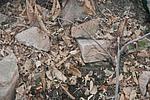
Official Name:
发台岭烽火台FaTaiLingFengHuoTaiOur Name:
/
Other Name:
/
Period:明 / Ming Dynasty 1368~1644
Location: 丹东市,宽甸满族自治县,位于宽甸满族自治县石湖沟乡亮子沟村发台岭山的主峰上。 / DanDongShi,KuanDianManZuZiZhiXian,WeiYuKuanDianManZuZiZhiXianShiHuGouXiangLiangZiGouCunFaTaiLingShanDeZhuFengShang
[
Looking Local List]
Details:长城类别:单体建筑
经纬高度:东经:124° 41′ 北纬:40° 43′ 海拔:384
建筑形式:土石混筑,以自然山体为基础,内填土,外包砌石块砌筑。
材料:土、毛石。
附近遗存:东南距双岭土城址6020米。
Type:烽火台 Beacon Tower
Protection Level:无
Content:
Memo:
Other Records:
Distribution:
visit location in Tianditu Map[recommend] Distribution:
visit location in Tencent QQ Map Distribution:
visit location in Google MapDistribution:
visit location in Baidu MapNational ID:210624353201170052
Action:[
 Save in Data Basket
 ]
Picture:
Click the thumbnail to view the Big Pic. Click the Big Pic to Hide the Big Pic![Caption:发台岭烽火台
loading images --Please wait...]()
![Caption:发台岭烽火台
loading images --Please wait...]()
![Caption:发台岭烽火台
loading images --Please wait...]() Photo Links
Photo Links:
 Search ::
  My Data Basket ::
  Favorite/My Favorite :: Recent Changes :: :: Login
 Save in Data Basket ]

